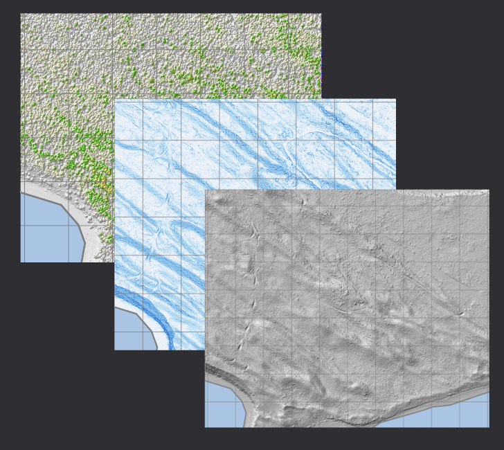
Introduction This week my boss asked me to gather and produce some LIDAR layers for the island that his family has a cabin on, and I thought it would be a great opportunity to show the workflow for processing compressed LAS point cloud data.
You can download all of the files used in this tutorial by cloning this repository. Included in the repo are the JSON pipelines, the LAS tiles I used, and some scripts to run some of the steps I cover below....
About Me
Born and raised in Winnipeg, MB, I spent my summers at my family cottage in the Whiteshell Provincial Park where I first discovered my love of nature. Eventually I decided (with a nudge from my brother) to go treeplanting in BC. It was during that first summer, and the following fall when I visited Vancouver Island for the first time, that I fell in love with this place and knew that one day I would call it home....
Hello World!
Hi there! Thanks for visiting my website. Those that have been here before may have noticed a bit of a change: I restructured the site to be more like a blog, allowing me to post content about the things I work on and am interested in, and be able to share things with whoever wants to hear it.
I decided to make this blog because I wanted a place to discuss the things I am interested in, and I wanted to share my knowledge with others....